
Le Guide Complet du Voyageur Indépendant au Costa Rica
Créé par Costa Planner — plus de 100 itinéraires organisés à travers tout le Costa Rica. C'est le guide que j'aurais voulu avoir à mon arrivée : tout, de la logistique aux coûts, en passant par la faune, les conseils par région, et mes partenariats locaux bâtis au fil des années.
Objectif : vous faire gagner du temps, de l'argent, vous éviter le stress et vous aider à découvrir le vrai Costa Rica.
Guide PDF Complet
Pas de spam, un seul email en retour.
Ce que contient le guide
Tout ce que j'aurais voulu avoir quand j'ai planifié mon premier voyage au Costa Rica.
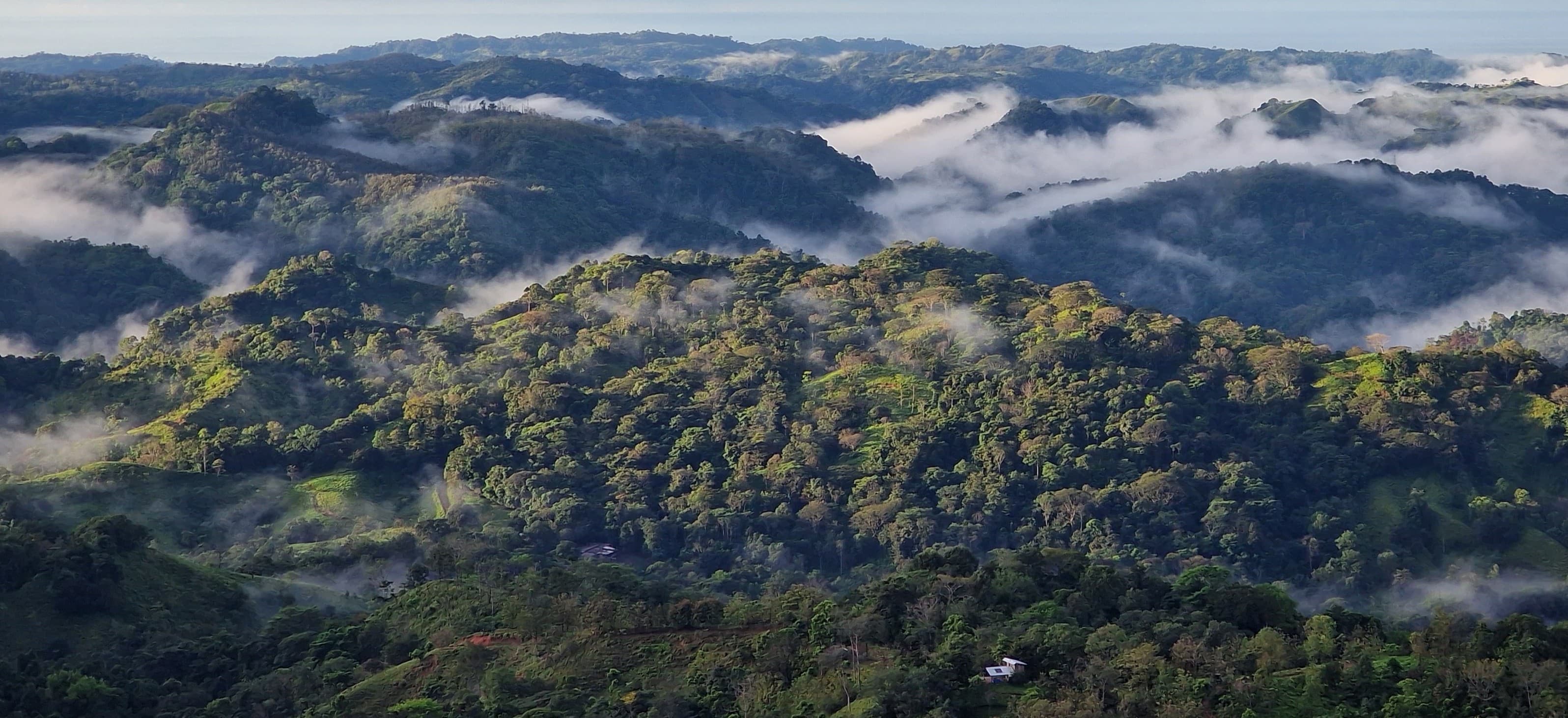
Détails des régions & points clés
Liens cartographiques détaillés pour chaque région. Chaque village qui vaut le détour, chaque point de vue, marchés locaux, fêtes de village et événements culturels à intégrer dans votre itinéraire.
Se déplacer
Voitures de location, navettes, bateaux et ferries — chaque option avec les vrais coûts et durées. Comment rejoindre Corcovado en bateau. La durée réelle des transferts. Où acheter un billet. Ce qu'il faut réserver à l'avance.
Toutes les régions et sous-régions
Pacifique Nord, Zone Nord, Pacifique Central, Pacifique Sud, Côte Caraïbe et Vallée Centrale — divisées en sous-régions là où c'est utile pour planifier.
Vrais détails des coûts
Estimations de budget journalier pour les voyageurs au budget serré, confort ou haut de gamme — avec des conseils pratiques pour réduire les dépenses sur la location de voiture, l'hébergement, le transport et la nourriture.
Spots faune et nature
Meilleurs emplacements pour l'ornithologie, la faune, l'observation des tortues et des baleines — avec les meilleures périodes et les contacts de mes guides locaux et naturalistes de confiance qui savent exactement où les trouver.
Saisons & timing
Ce que j'ai appris en vivant ici sur le climat complexe et imprévisible du Costa Rica — à quoi s'attendre, comment se préparer, et comment lire les saisons pour aller au bon endroit au bon moment.
Conduire au Costa Rica
Règles de conduite, avertissements pour la saison des pluies, quelles routes nécessitent un 4x4, traversées de rivières, contrôles de police et une checklist complète avant location. Tout ce que j'ai appris au fil des années de conduite ici.
Mes Partenariats Locaux
Hôtels, lodges, écoles de surf, opérateurs de rafting, guides de parcs nationaux — tous vérifiés personnellement, avec des tarifs négociés. Pour économiser et réserver en toute confiance, pour la plupart sans prépaiement.

Une catégorie à part entière.
Lorsqu'on commence à se renseigner sur un pays ou à préparer un voyage, on se tourne généralement vers des articles, des guides, des vidéos ou des livres de voyage. La plupart de ces ressources sont là pour inspirer, faire découvrir une destination et fournir des informations générales. En revanche, rares sont celles qui aident vraiment à préparer un voyage. Ce guide a été conçu pour les voyageurs qui souhaitent découvrir le vrai Costa Rica et qui ont besoin d'informations concrètes pour organiser leur voyage dans les meilleures conditions.
Si vous voulez en apprendre davantage sur le pays — histoire, culture, informations générales : Lonely Planet, Moon Guides, Routard.
Idées de voyages et inspiration : influenceurs voyage, blogs de voyage, Instagram.
Pour les voyageurs qui souhaitent planifier leur voyage dans les règles de l'art : Costa Rica Independent Traveler's Guide →Ce guide a été créé avec la contribution de partenaires locaux, voisins et amis. Un grand merci à eux !
Besoin d'un plan maintenant ?
Pendant la préparation du guide, je propose des itinéraires sur mesure complets ou des consultations de planification de voyage.
Questions fréquentes
Que contient le guide ?
Chaque région et sous-région du Costa Rica — les vrais coûts, les conseils transport, les consignes de conduite, les meilleurs endroits pour observer les animaux, et les contacts de mes partenaires locaux. Conçu pour planifier, pas pour rêver.
Est-ce un livre papier ou un PDF ?
Un PDF numérique que vous lisez sur n'importe quel appareil — téléphone, tablette ou ordinateur, avec des liens vers les cartes interactives et les ressources.
En quoi est-ce différent d'un Lonely Planet ou d'un blog de voyage ?
Les guides expliquent le pays, les blogs vendent du rêve. Ce guide, lui, vous aide vraiment à planifier et à réaliser le voyage : la logistique, les vrais coûts, les contacts qui prennent des années à bâtir — et mes partenaires locaux avec leurs tarifs négociés, pour voyager mieux et dépenser moins.
Le guide est-il actualisé ?
Oui, je le mets à jour dès que j'ai des nouveautés : partenariats, conseils de locaux, codes promo, activités.
Être notifié quand il est prêt
99$ au lancement. Créé par quelqu'un qui vit au Costa Rica.
Guide PDF complet. Toutes les régions et sous-régions. Liens de cartes cliquables. Fonctionne sur n'importe quel appareil.